
The Catonsville to Baltimore Greenway
Striving for expanded access to opportunity through transportation and recreational trail systems.
Join our Coalition!
Please email Cameron at Walkup.cameron@gmail.com for more information about joining our efforts. We generally hold meetings on the last Wednesday of each month at 6pm at St. Agnes Hospital.

Contents:
Existing Trails
The Proposed Greenway
Obstacles to the Greenway
Potential Solutions
Existing Trails
The Catonsville Short Line Trail
Catonsville Rails to Trails formed in 1998 and began building the Catonsville Short Line Trail within the Catonsville portion of the historic Short Line Railroad right-of-way in Baltimore County. The adjacent map displays completed sections in dark green, planned sections in light green, and sections in progress in red.
The current Catonsville Short Line Trail is a ~2.2-mile woodland trail with sections near downtown Catonsville, Spring Grove, 695, Paradise, and Beechfield.
CRTT plans to construct and maintain the full CSLT as a ~3 mile continuous trail from downtown Catonsville to S. Beechfield Ave.


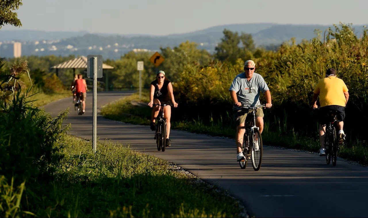
The Gwynns Falls Trail

Beginning in the 1990s, Baltimore City, nonprofit organizations, and local residents began designing and building the Gwynns Falls Trail in western Baltimore City.
Today, the GFT is a ~22 mile trail network, including a ~11 mile mainline trail.
The trail connects dozens of west and southwest Baltimore neighborhoods with parks, historical and cultural landmarks, and the urban business district.

Baltimore Greenway Network
The Gwynns Falls Trail is a key component of the Baltimore Greenway Trails Network, a partially constructed/proposed 35- mile system connecting communities, parks, businesses, and other locations across the city.
Many of our communities currently lack direct, safe walking/biking access to the Gwynns Falls Trail and the rest of the trail network.


The Proposed Greenway
The Proposed Catonsville to Baltimore Greenway
The Goal: Create a direct, safe connection for active transportation to and from Catonsville and downtown Baltimore, and all the communities, businesses, parks, and other places in between.
With the planned Catonsville Short Line Trail and existing Gwynns Falls Trail, all that is needed to complete this Greenway is ~2 miles of new multi-use paths to create a ~9 mile Greenway from downtown Catonsville to the Inner Harbor as shown in the map below.

Baltimore Rec and Park’s previous master plans for our city trail system has included this stretch of trail in various ways as indicated by the following maps.
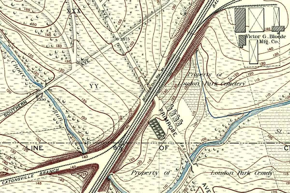
The Baltimore Trail System map shows a plan to run the Catonsville Short Line trail through Loudon Park Cemetery connecting directly to Frederick Ave.
The Proposed Bicycle Routes and Facility Types map indicates plans to continue this trail through the neighborhood of Gwynns Falls along the historic rail right-of-way to eventually connect with the existing Gwynns Falls Trail.

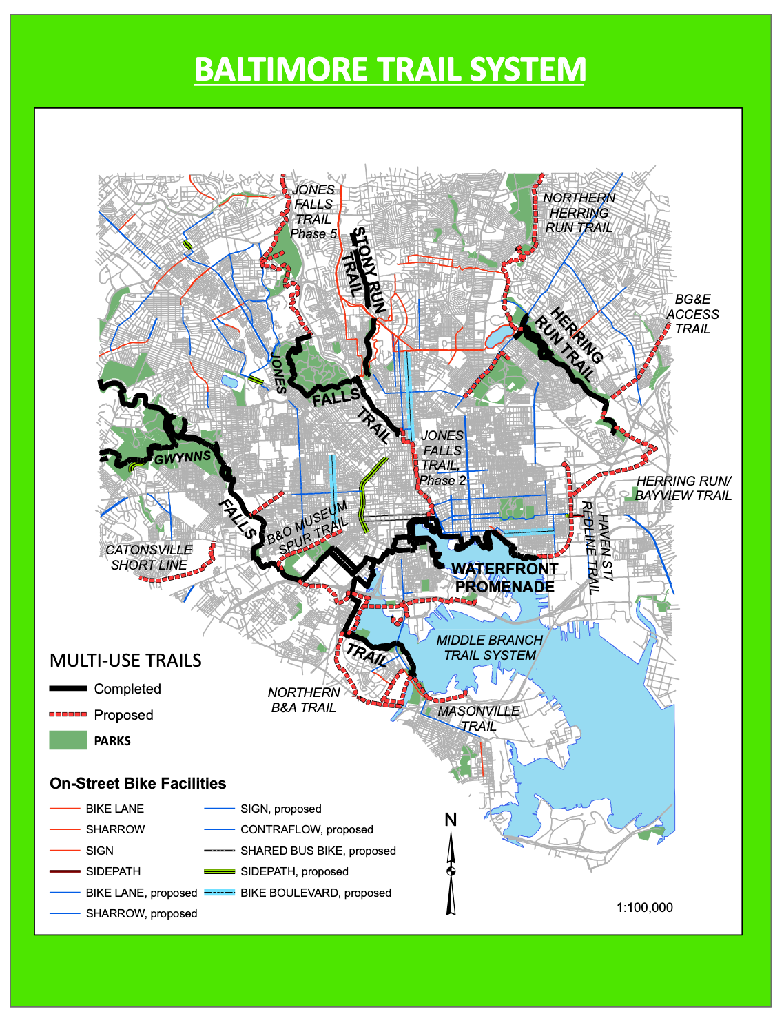
Both maps indicate some previous drive within Baltimore City planning to place a trail along this route. The proposed route can be broken up into a couple of different logistical hurdles; the Loudon Park Cemetary, the Primrose Passageway, and the Claremont Branch.

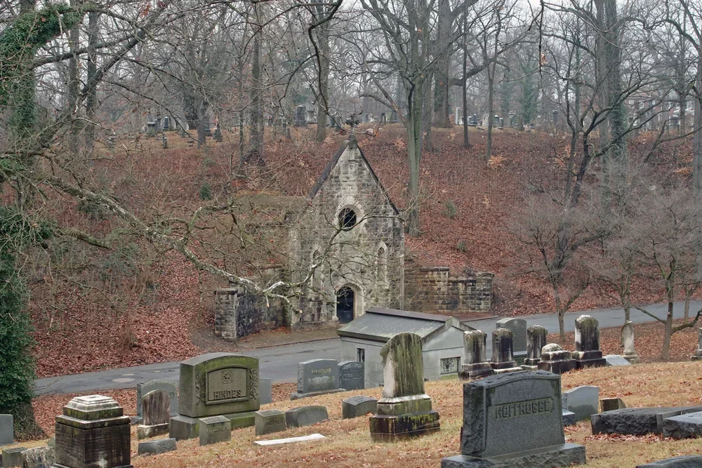
The Loudon Park Cemetery
This is an approximately 1 mile stretch of the proposed trail within the Baltimore City owned original railroad right-of-way. The proposed trail would enter the park at S Beechfield Ave and exit through the Primrose Passage.
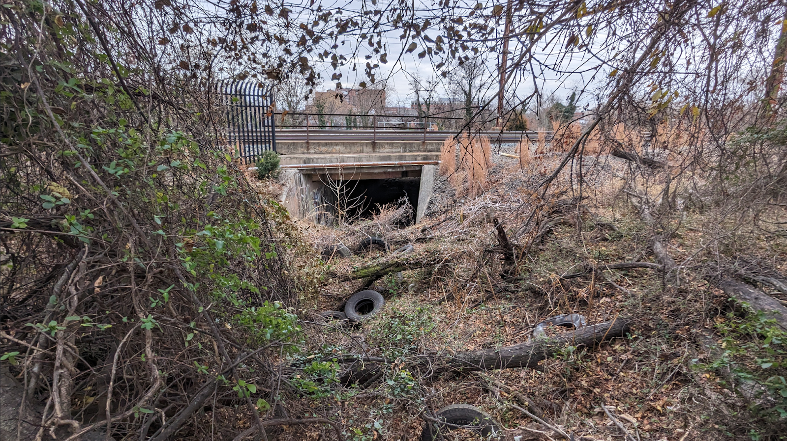
The Primrose Passageway
The main entrance to Loudon Park Cemetery was originally from the south under the railroad tracks via Primrose Avenue. Today, Primrose Ave is Primson Ave and does not cross the railroad or Maiden Choice Run, however, the Primrose Passageway remains.


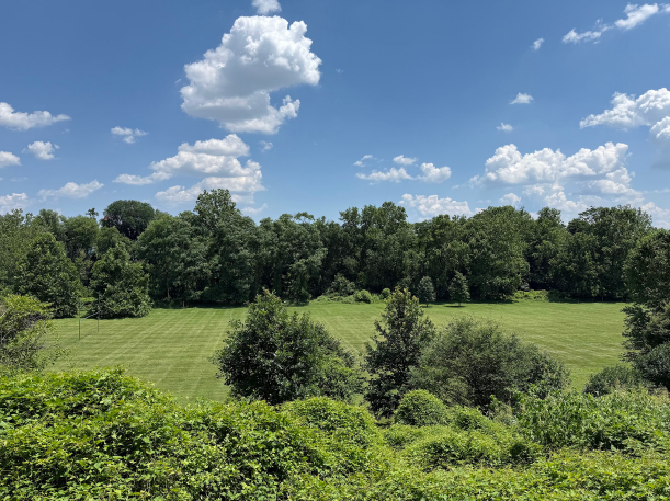
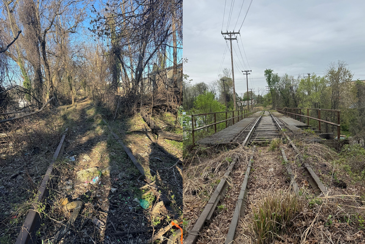
The Claremont Branch
The Claremont Branch is a short railroad spur (1.2 miles) off the NEC owned by Norfolk Southern that connects to the Mt. Clare Railroad Yard.
The spur starts approximately 500 ft north of the Primrose passageway and includes bridge crossings over S Caton Ave and Wilkens Ave.
While the railroad is not officially “abandoned,” it has not been used in decades and would require significant investment to restore to rail use.
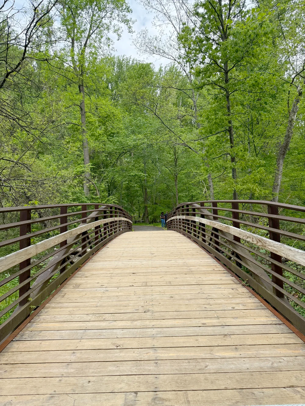
Rail corridors like this are great for conversion into all-ages trails because of their generally minimal slope and separation from roads.


Obstlacles to the Greenway
Loudon Park Cemetery Right-of-way
Ownership of the Catonsville Short Line Railroad right-of-way within Loudon Park Cemetery is disputed.
The Cemetery has recently begun burying people in a small portion of the right-of-way and filled in a portion of the right-of-way for a road.
Primrose Passageway Permission
Amtrak permission would be needed for use of the Primrose Passageway because it is within their right-of-way.
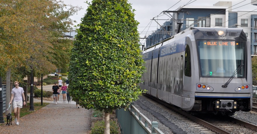
MTA is currently desiging the Purple Line in Montgomery County as a rail-with-trail alongside the Capital Crescent Trail shown in the map below and in a speculative rendition.
Baltimore can have rail-with-trail too!


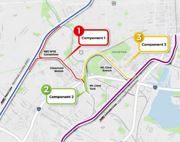
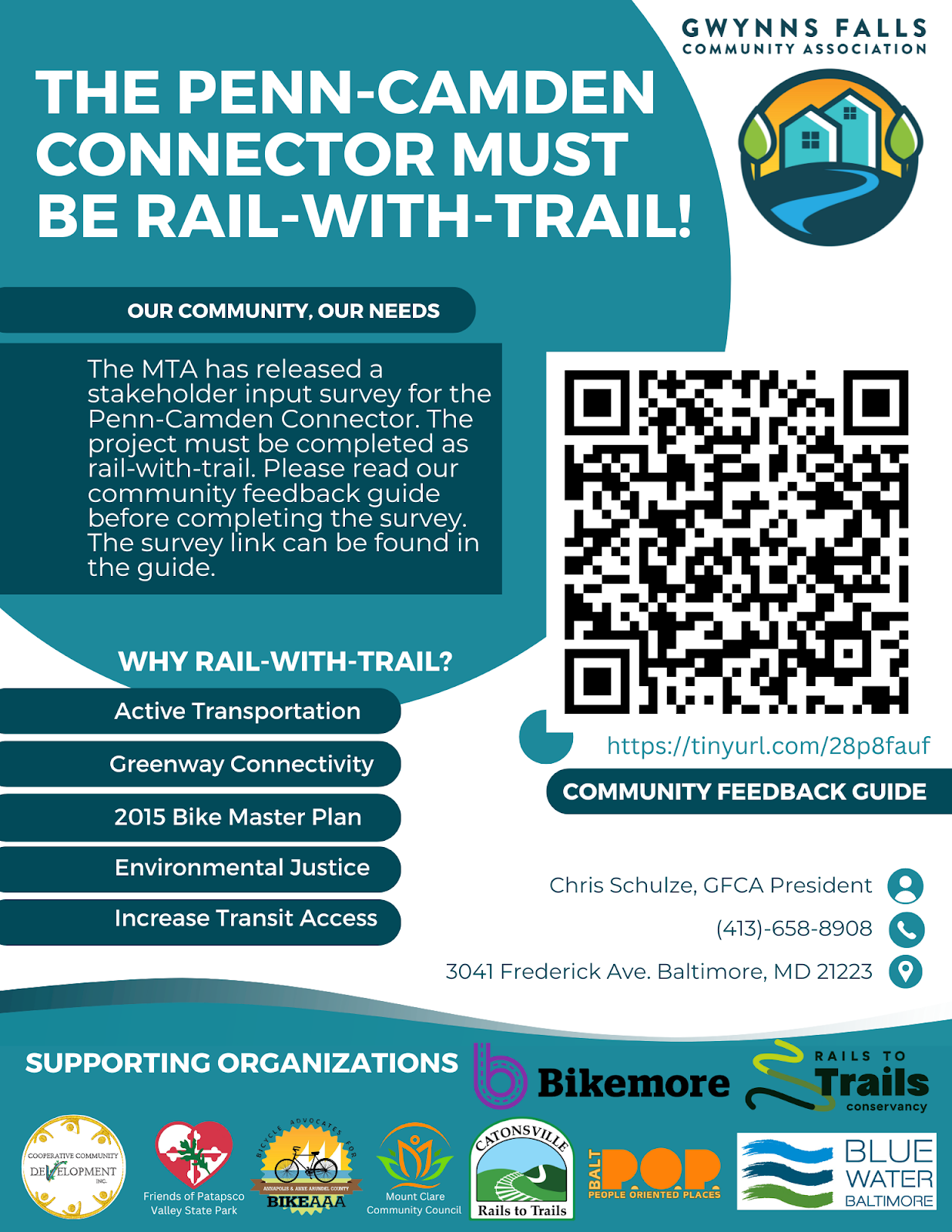
Claremont Branch Re-Activation (Penn-Camden Connector)
Although the Claremont Branch is not currently in use, the Maryland Trasporation Administration (MTA) has proposed using the right-of-way to connect the Penn and Camden MARC lines.
In 2023, MTA received a federal grant ($8.8 million) to begin studying and designing the Penn-Camden Connector (PCC).
Several individuals and organizations here started a campaign to urge MTA to build the Penn-Camden Connector as a rail-with-trail.
Multiple organizations and elected officials have supported this request.
Rail-with-trail allows for multiple beneficial uses of a corridor, rather than picking between railroad or trail.
There are over 900 miles of rail-with-trail projects across the country, from more than 25 miles long to just 0.1 miles long; some examples of already existing rail-with-trail projects are shown below.


MTA has said so far that they do not intend to design the PCC as rail-with-trail because of the costs and logistical hurdles.
However, MTA is continuing to solicit stakeholder feedback this summer and does not expect to complete 30% design until next fall/winter.

How Do I get Involved?
Equal access to effective transportation options involves both a strong rail system and well developed trail infrastructure. We implore MTA to develop our rail system in a way that is effective and accessible to all by including trail planning particularly when developing in lower income neighborhoods.
-
Please email Cameron at Walkup.cameron@gmail.com to join our committee
Coalition meetings generally take place on the last Wednesday of the month at St. Agnes Hospital at 6pm. Please reach out for more info.
-
MTA is currently soliciting information from the public. Please email them at penncamdenconnector@mdot.maryland.gov with any comments or concerns.
The official MTA Penn-Camden Connector website can be found here.
-
Reach our to your council member to defend city ownership of the historic Shore Line Trail greenway as it runs through Loudon Park Cemetery.
Find your council member here.
-
MTA has received feedback from constituents that in person presentations are a prefered method of sharing information about this project. Help provide avenues for the MTA to do just that and invite them out to your event (i.e. community organization meeting, coalition gathering, etc.) to present on the Penn-Camden Connector project.
This information is brought to you through partnership with the following organizations
-

Catonsville Rails to Trails
-

Gwynns Falls Community Association
-

Bikemore
-

Mount Clare Community Council
-
Rails to Trails Conservancy
-
Westgate Community Association
-
Kensington Improvement Association
-
Catonsville to Baltimore Greenway Coalition
-
Beechfield Community & Improvement Association
-
Cooperative Community Development